Tesla has introduced the latest Tesla update, version 2025.38, to the masses, or at least to the lucky 1% of owners who’ve received it so far.
While this update isn’t huge, it does include major new features, with the most noteworthy being new 3D buildings in the map view.
3D Buildings
Tesla map now with 3D buildings and houses pic.twitter.com/WTgQ46blQp
— Chunk (@AhoyChunk) October 9, 2025
3D buildings can be enabled in the map view, allowing you to view almost any house or building in 3D. It makes the maps pop and adds a much-needed feature that has been available on other vehicles like Rivian.
To view 3D buildings, the user must enable them, which is a new toggle on the right side of the screen on the Model 3 and Y, right next to the radar button. 3D buildings are then automatically displayed at higher zoom levels; however, they’re hidden if you zoom out too far. You also can’t combine 3D buildings with satellite view as expected.
You can drive with the 3D buildings being displayed, which makes it not only a nice visual effect but also beneficial in navigation. The buildings can make it more obvious where to turn by connecting the intersection with your surroundings.
3D Maps
Great @Tesla Update Version 2025.38
— arpy (@arpysystems) October 9, 2025
New 3D buildings view feature works nice!
Showing St. Stephen's Cathedral, Vienna. https://t.co/rr0ZOzLMDi pic.twitter.com/dh6t39SiBP
3D buildings aren’t the only addition to the maps. While you could always zoom in and rotate Tesla’s maps, you could tilt the view before, adjusting the angle you’re looking at the maps.
While this only works with 3D buildings enabled, you can put two fingers on the touchscreen and pan up and down to adjust the viewing angle of the map.
Future Updates
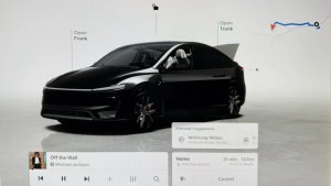
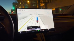
With the addition of 3D buildings, Tesla is closing in on duplicating what’s shown in the vehicle’s visualization and what’s displayed in the map view. We could see Tesla eventually merging these two features and incorporating map data, such as the buildings and your route path, into the vehicle’s visualizations.
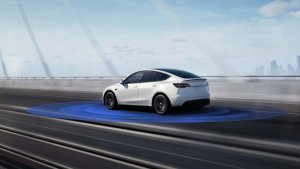
While the vehicle’s visualizations serve more as real-time visuals of the surrounding environment, and the map view is more for archived or map data, the lines are getting increasingly blurred. Tesla now displays map data in the visualization view to help both the vehicle and its users better understand their surroundings.
During the Cybertruck’s prototype stage, Tesla shared a prototype UI that did exactly this. The vehicle’s visualizations were a part of the map view. You could see your vehicle, the navigation route, 3D buildings, streets, and your path, all together in one view.
Tesla has also been experimenting with adding 3D terrain to the visualization view, letting roads show elevation and surroundings show hills. If they’re still planning to do this, it may make sense to show 3D buildings that are near the vehicle in the visualization view as well.
Google API
Tesla is likely leveraging the Google API to get the data needed for the new 3D buildings, which is how they’ve been able to launch the feature across most countries. The feature appears to be available worldwide, except in China, where Tesla uses a different map provider.
Availability
The new 3D buildings are available on the Model 3 and Model Y with the AMD Ryzen infotainment unit. It’s also available on the Cybertruck and presumably will be available on 2021+ Model S and Model X when the update starts shipping to those vehicles as well.
However, the feature does require Premium Connectivity. While some Premium Connectivity features are available on WiFi, this isn’t one of them.