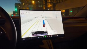
Finding your way around Supercharger stations just got a lot easier from your phone. Tesla has brought its detailed charger layouts beyond the in-car touchscreen, introducing 3D Supercharger Site Maps directly inside the mobile app.
The feature has begun rolling out to drivers starting in Tesla app version 4.61.0 (and later), giving owners a real-time birds-eye perspective of station layouts, open charging stalls, and physical obstacles before ever pulling into a lot.

Mobile Visuals and Platform Differences
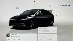
While in-car screens render station layouts within a fully interactive 3D space, the mobile implementation is a bit more restrained. On your phone, the Site Map acts as an overhead layout rather than a rotatable environment. You can zoom in and out, but you can’t spin the perspective around or inspect vehicles from custom camera angles like you can on the center screen.
Tesla also appears to be relying on a separate mapping layer to serve these layouts on your phone. As you zoom in on a supported Supercharger, there’s a slight visual lag before the Site Map pops onto the display. Once the Site Map loads, you lose the Apple Maps details for the surrounding area and are instead served Tesla’s tailored Suspercharger canvas showing stalls, parking spaces, lanes, and vehicles.
From 18 Test Hubs to Nationwide Coverage
Tesla first launched 3D Supercharger Site Maps last year as part of the 2025 Holiday Update. At the time, the feature was limited to just 18 pilot locations across California and Texas.
Scaling it up across the Supercharger network, which boasts more than 80,000 stalls globally today, required heavy lifting behind the scenes. Tesla previously noted that its engineering and mapping crew at Giga New York was bringing over 300 Supercharger sites worldwide into the fold every week.
After expanding 3D Site Maps to Canada earlier this spring, the rollout gained serious momentum. Today, coverage blankets the vast majority of the U.S., with nearly every domestic Supercharger location now boasting its own Site Map.
Cybercab Site Map Model Arrives on Mobile
Curiously, the mobile app is actually ahead of vehicle software in one fun visual area: vehicle models. In the car display, charging spots occupied by Tesla’s Cybercab still render as a standard vehicle as of the Summer Update (version 2026.26 and later) despite Tesla announcing earlier this month that dedicated models for the autonomous vehicle were coming to Site Maps.

On the mobile app, however, Tesla has already incorporated the 3D model for the Cybercab. If you want to spot one plugged into a stall on your phone, Austin is your best bet — it currently remains the only city where the steering wheel-less vehicles are running commercially on the Robotaxi network.
With the Cybercab asset already active in the mobile app, it likely won’t be long before the in-car display catches up. In the meantime, having 3D Site Maps right in your pocket makes planning charging stops that much smoother.